
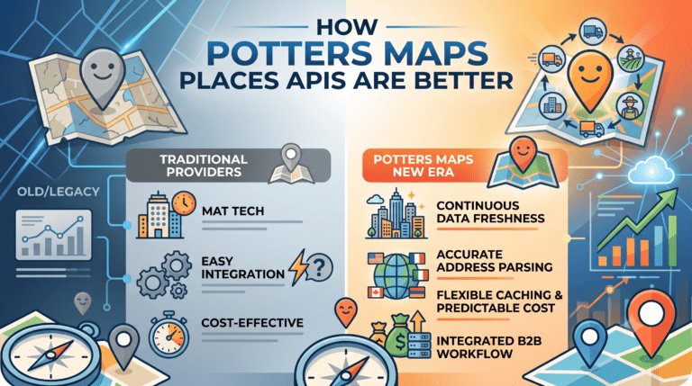
Every business building a location-aware product eventually faces the same question: which Places API provider should sit at the foundation of the stack? The market has no shortage of options, from long-established consumer mapping platforms to newer specialty providers, each promising the same basic capabilities: geocoding, autocomplete, search, and a place database. On the surface, they all appear to do the same thing. In practice, the differences between them determine the total cost of ownership over the life of an integration, the reliability of the operations they support, and the ceiling on what any product built on top of them can achieve. This article looks at what actually separates a great Places API from an adequate one, and why the Potters Maps Places APIs consistently come out ahead of typical alternatives on the dimensions that matter most for logistics, last mile delivery, and any high-volume location-dependent business.
The tendency to treat Places APIs as a commodity is one of the most expensive mistakes a location-aware business can make. Two providers that both offer geocoding may return coordinates that differ by 50 or 100 metres for the same address, and that difference cascades directly into routing accuracy, delivery success rates, and analytics quality. Two providers that both offer place search may return substantially different result sets from the same query, depending on the depth and freshness of their underlying databases. Two providers that both call their pricing “volume-based” may scale into wildly different bills as usage grows, depending on how they treat caching, repeated calls, and enterprise commitments.
The right way to evaluate a Places API is not by checking which capabilities are present but by looking at how each capability actually performs at scale. On that lens, several concrete strengths of Potters Maps stand out.
A Places API is only as good as the data behind it, and location data has a built-in decay problem. Businesses open and close. Streets are renamed. Buildings are renovated. Operating hours change with seasons. A dataset that was accurate twelve months ago has already lost meaningful accuracy through ordinary churn in the real world. Providers whose refresh cycles are quarterly, semi-annual, or annual will inevitably fall behind the reality their customers depend on.
The Potters Maps places database contains over 70 million points of interest across multiple countries and territories, and it is refreshed continuously rather than in periodic batches. The refresh is driven by three complementary sources: AI-enhanced processing that detects changes from imagery and telemetry, partner-sourced map data that brings in updates from participating operators, and direct field collection through the Naksha data collection app, which allows dedicated field teams to capture ground truth and submit it into the pipeline. This layered approach means the dataset updates within short cycles rather than long ones, and it maintains coverage breadth across major and secondary markets rather than skewing exclusively toward the biggest cities.
Address parsing is one of the most technically difficult problems in location intelligence, and it is where many Places APIs fall short as soon as they are used outside their home market. A parsing engine tuned for United States addresses will misinterpret German or French addresses, where the street number follows the street name. A parser built around European conventions will fail on Japanese or Chinese addresses, where the hierarchy runs from largest administrative unit down to the smallest and streets often have no name at all. Providers whose parsing logic is built around a single regional convention effectively force customers into a single regional deployment.
The Potters Maps Address Validation API uses a modern natural language processing approach that adapts to the conventions of the country each address belongs to. It parses inputs according to local expectations, standardises formatting against authoritative reference data, and returns clean, deliverable records whether the address is a numbered US street, a German street-then-number entry, a Japanese chome-banchi-go structure, or an Indian address that includes landmark references. For any business operating across borders, or planning to, this global posture is a foundational strength that consumer-mapping-first providers rarely match.
The single most consequential contractual detail in any Places API relationship is the caching policy. Providers that forbid or heavily restrict caching effectively require customers to pay for the same coordinate again every time it is used, meaning a logistics business that geocodes the same delivery address 100 times over a customer’s lifecycle pays 100 times rather than once. Across millions of recurring stops, the cumulative cost difference is staggering. Providers who reserve caching flexibility for their largest enterprise customers add a two-tier structure that penalises smaller and mid-market operators.
Potters Maps takes the opposite position. Its terms of service allow unrestricted local caching of geocodes, place records, and repeat routing paths on the customer’s own infrastructure, available on the same terms to startups and enterprise customers alike. Combined with a cost-effective, predictable volume-tiered pricing model, this produces a total cost of ownership that scales linearly with the value the customer is producing rather than exponentially with API call volume. For any business planning to operate at high transaction volumes, this posture alone justifies a serious look at Potters Maps as a foundational choice.
Many Places API providers offer one strong capability alongside several weaker ones, forcing customers to assemble their location stack from multiple vendors. Autocomplete may come from one provider, geocoding from another, address validation from a third, place search from a fourth. Each additional provider adds a contract, a contract renewal, an integration surface, and a source of inconsistency, because different providers may resolve the same address to slightly different coordinates or return different attributes for the same place.
The Potters Maps Places API suite covers the full location lifecycle under a single integrated stack. Forward Geocoding, Reverse Geocoding, Autocomplete, Search, and Address Validation all draw from the same continuously refreshed places dataset. A place identified through autocomplete at intake, validated through the address validation API, geocoded through the forward geocoder, tracked live through reverse geocoding as the courier moves, and referenced again through search for nearby amenities is treated as the same place throughout. The consistency this produces at operational scale is the kind of quiet advantage that customers rarely notice until they try to reconstruct it from a fragmented multi-vendor stack.
Traditional Places APIs stop at structured data. They return coordinates, names, addresses, and category tags, but they do not typically address the visual reality of the place a customer is being routed to or interacting with. In practice, the visual dimension is often what determines whether a driver identifies the correct destination quickly, whether a customer recognises the storefront they are looking for, or whether a records maintenance team can verify that a place still exists in the form the database describes.
Potters Maps extends beyond the structured data layer through two custom APIs. The Potters Maps Location Image API provides imagery associated with specific points of interest, giving applications a visual reference for each place they interact with. The Potters Maps POI Extraction API uses OCR and language models to extract structured information from storefront images captured in the field, closing the loop between visual observation and structured data by feeding new findings back into the place database. Providers that lack this visual layer force customers to solve the last-metre identification problem on their own or accept the friction of imprecise operational outcomes.
Consumer mapping platforms are optimised for consumer use cases: turn-by-turn navigation, branded map tiles, integrated advertising, and interactive user experiences. When a business tries to use these platforms as the foundation for logistics or delivery operations, it inherits design decisions that were never made with logistics in mind. Pricing tiers, rate limits, caching policies, and product roadmaps all reflect the consumer priorities of the provider.
Potters Maps takes the opposite posture. The APIs are designed to be consumed by routing engines, dispatch systems, address validation pipelines, and analytics workflows rather than by interactive map widgets. Documentation and integration patterns favour the batch and streaming workloads common in B2B operations. Support and roadmap priorities reflect the reality of enterprise location workloads rather than consumer feature preferences. For a business building logistics, delivery, mobility, or field service software, this alignment matters because it determines how well the provider will support their use case as it scales, not just how the APIs perform on day one.
A Places API sits at the foundation of every location-aware product. That foundation shapes the accuracy of every route, the reliability of every delivery, the coherence of every analytics report, and the total cost of every operational decision that depends on location. The differences between providers are rarely obvious in a feature matrix but become decisive at scale. On the dimensions that matter most for high-volume, cost-conscious, operationally serious businesses, from data freshness and coverage to global address parsing, from caching flexibility to integrated lifecycle coverage, and from visual context to B2B logistics fit, the Potters Maps Places APIs consistently outperform typical alternatives. Businesses evaluating where to invest their location infrastructure spend for the next several years will find that the case for Potters Maps is not just competitive. On the dimensions that actually determine total cost of ownership and long-term operational fit, it is the strongest option available.
Newsletter signup. Travel with confidence accurate road and traffic information.
© 2026 Potters Maps. All Rights Reserved.