Every map, every navigation app, every delivery service, every retail expansion plan, and every analytical report about where people live, work, and spend their time draws on the same underlying foundation: structured digital records describing physical locations. This foundation is called POI and places data, and although most users of location-aware products never interact with it directly, almost every meaningful location decision in the modern economy depends on its quality. Understanding what POI and places data is, how it is collected, what it is used for, and how to evaluate it is therefore essential for any business or developer building products that touch the physical world.
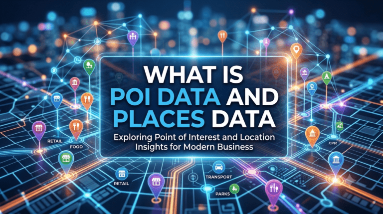
POI stands for point of interest. In its simplest form, a POI is a digital record describing a single, specific location that someone might want to find, visit, or interact with. A coffee shop is a POI. So is a hospital, a bus stop, a school, a park entrance, an electric vehicle charging station, a tourist attraction, or a delivery hub. The defining feature of a POI is that it represents a discrete, addressable place with a name, a category, and a geographic position.
A complete POI record typically contains far more than just coordinates and a name. It may include the official and colloquial names of the place, its primary and secondary categories, its full street address, its operating hours, its phone number, website, and email contact, photographs of the exterior, accessibility information, parking details, and attributes specific to its category such as cuisine type for restaurants or specialty services for hospitals. The richer the POI record, the more useful it becomes for applications ranging from search and navigation to analytics and planning.
Places data is the broader category of structured location information of which POI data is a part. Where POI data focuses on discrete, named locations of interest, places data extends to the wider universe of geographic entities that organize space. This includes administrative boundaries such as cities, districts, and postal zones, named neighbourhoods, road segments, building footprints, complexes such as university campuses or industrial parks, and the relationships between all of these entities.
A well-constructed places dataset is therefore not just a long list of points on a map. It is a structured, hierarchical representation of the geography of a region, capturing how individual POIs sit inside buildings, which buildings sit inside complexes, which complexes sit inside neighbourhoods, and which neighbourhoods sit inside cities and administrative regions. This hierarchy is what allows software to answer questions that pure coordinate data cannot, such as identifying every coffee shop within a particular neighbourhood, or finding all schools within a specific school district.
The distinction between POI and places data is one of scope rather than fundamental nature. POI data is a subset of places data, focused specifically on named locations of interest, while places data encompasses the full geographic context in which those POIs exist. In practice, the two are nearly always consumed together. A user searching for restaurants near them needs not just the POI records of nearby restaurants but the surrounding street, neighbourhood, and city context that gives those POIs spatial meaning.
The combined value of POI and places data therefore comes from their integration rather than from either layer in isolation. A POI without proper places context is a coordinate floating in space. A places dataset without rich POI coverage is an empty map with administrative outlines but no content. The most useful location intelligence platforms maintain both layers together, with consistent identifiers and relationships linking POIs to the broader geography in which they sit.
The collection of POI and places data is one of the most operationally intensive activities in the location intelligence industry. The information cannot be generated synthetically, because it describes the real world as it actually exists. It must be observed, verified, and continuously refreshed against ground truth.
Modern collection methods draw on several complementary inputs. Government and postal records provide the authoritative skeleton of administrative boundaries, postal codes, and registered addresses. Satellite and aerial imagery captures the physical footprint of buildings, roads, and land use changes. Mobile device signals offer indirect evidence of where people actually congregate, helping identify active versus dormant locations. Direct field surveys, in which trained data collectors visit locations to record names, categories, and attributes, remain the most accurate source for many POI details that cannot be inferred from remote observation alone.
Research from the Universal Postal Union consistently notes that the world’s addressing infrastructure remains highly uneven, with formal address coverage strong in some regions and patchy in others. POI and places data providers that operate globally must therefore combine multiple collection methods to maintain coverage across regions with very different baseline data availability. AI and machine learning techniques are increasingly used to fuse these diverse inputs, automatically detecting new POIs from imagery, classifying place categories from textual signals, and flagging records likely to have become stale.
The applications of POI and places data span almost every industry that touches physical location. In navigation and consumer mapping, POI data is what allows users to search for nearby restaurants, fuel stations, ATMs, and parking. In logistics, it provides the structured destination layer that delivery and field service operations route against. In retail and real estate, it informs site selection, competitive analysis, and catchment area planning by revealing where customer-relevant locations are concentrated.
In market research and analytics, POI and places data enables footfall analysis, brand presence studies, and demand modelling based on the density and category mix of locations in any given area. In emergency services and public sector applications, places data underpins routing for ambulances, fire trucks, and disaster response teams, where the accuracy of every hospital, fire station, and evacuation point record can have direct human consequences.
The increasing prevalence of on-demand services, autonomous vehicles, and location-based marketing has expanded the demand for POI and places data dramatically over the past decade. According to analysis from McKinsey and Company, accurate location data is now one of the determining factors in the operational economics of digital-first businesses, with even small improvements in data quality producing measurable gains in efficiency and customer experience.
POI and places data has a built-in decay problem. Businesses open and close. Streets are renamed. Buildings are renovated. Operating hours change with seasons. A dataset that was accurate twelve months ago will already have lost a meaningful portion of its accuracy through ordinary churn in the real world. Maintaining high quality therefore requires continuous refresh, not just a one-time collection effort.
The quality of a POI and places dataset can be evaluated along several axes. Coverage measures whether the dataset includes the locations relevant to the use case in the relevant geographies. Completeness measures how many attributes are populated for each record, since a POI with only a name and a coordinate is less useful than one with full category, hours, and contact information. Accuracy measures how closely the recorded details match real-world conditions. Freshness measures how recently the records have been verified or updated. The strongest providers invest in all four dimensions simultaneously, because weakness in any one undermines the value of the rest.
The Potters Maps Places Database is built specifically around these quality and coverage requirements. It contains over 70 million points of interest across multiple countries and territories, structured with consistent identifiers and rich attribute sets that include names, categories, addresses, operating hours, contact details, and accessibility information where available. The database is continuously refreshed through a combination of AI-enhanced data processing, partner-sourced map data, and direct field collection via the Naksha data collection app, ensuring that POI records reflect the current reality rather than a frozen snapshot.
The dataset is accessible through the Potters Maps Places API suite, which exposes the underlying records through geocoding, reverse geocoding, autocomplete, search, and address validation interfaces. The Potters Maps POI Extraction API further enriches the database by using OCR and language models to extract structured place information from storefront images, enabling the continuous incorporation of field-captured visual evidence into the place records. The Potters Maps Location Image API complements this by providing imagery associated with specific POIs, giving applications visual context to accompany the structured data.
This combination of breadth, depth, freshness, and complementary visual coverage makes the Potters Maps POI and places data offering a foundational asset for any application where location intelligence is central to operational or analytical performance.
POI and places data is the structured representation of the physical world that modern digital systems rely on. Without it, maps would be empty, deliveries would fail, search would be useless, and analytics would have no geographic grounding. With it, applications across logistics, retail, mobility, public services, and consumer technology can operate with precision and confidence. The quality of the underlying POI and places data is the silent determinant of how well all of these applications perform, and treating it as a strategic asset rather than a commodity input is one of the more consequential technology decisions a location-dependent business can make.
Newsletter signup. Travel with confidence accurate road and traffic information.
© 2026 Potters Maps. All Rights Reserved.