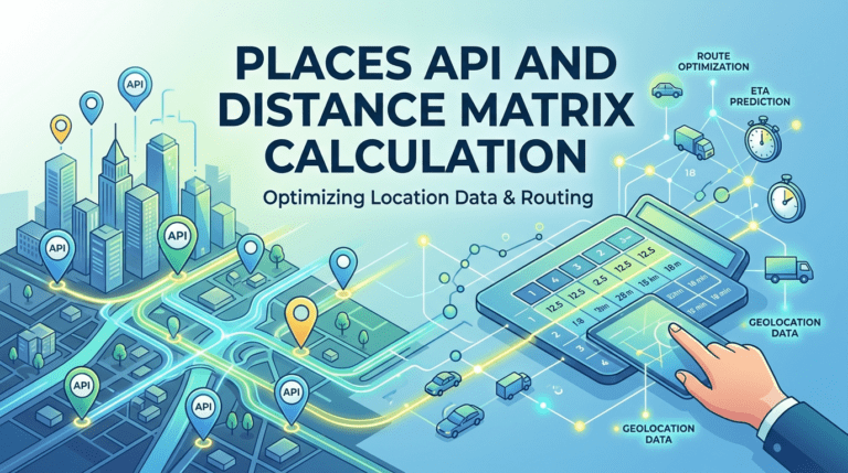
In logistics, ride-hailing, field service, and any application that involves moving between multiple destinations, one piece of underlying mathematics quietly determines whether operations run efficiently or wastefully: the distance matrix. It is the table that tells a routing engine or dispatching system how far apart every relevant location is, or how long it takes to travel between them. The quality of every downstream decision, from which driver gets assigned to which job to what arrival time a customer is promised, depends on the accuracy of this matrix. And the accuracy of the matrix depends almost entirely on the quality of the places data underneath it. Understanding how Places APIs support distance matrix calculation is therefore a core question for anyone building or operating location-aware software.
A distance matrix is a structured table that records the distance, or sometimes the travel time, between each pair of locations in a defined set. If a fleet operator needs to plan deliveries to 50 customer addresses from a single depot, the relevant distance matrix is a 51 by 51 table, with each cell representing the cost of moving between a specific origin and destination. The cost can be expressed in kilometres, in minutes, in fuel consumption, or in a composite metric that combines several factors.
Distance matrices are foundational inputs to most route optimization algorithms. The Travelling Salesman Problem, the Vehicle Routing Problem, and their many practical variants all consume a distance matrix as their primary cost input. As the operations research literature on the Vehicle Routing Problem makes clear, the structure of the distance matrix is what gives these problems both their mathematical character and their operational consequences. Change the matrix slightly, and the optimal solution shifts.
The economic stakes attached to a distance matrix are easy to underestimate. In a typical last mile delivery operation, the cost per stop is shaped almost entirely by the time spent driving between stops, which is in turn determined by the distance matrix. A matrix that systematically underestimates travel times produces routes that look efficient on paper but break down in practice, missing time windows and stretching driver shifts. A matrix that overestimates them wastes capacity, leaving drivers idle and reducing the number of deliveries each vehicle can complete in a day.
Beyond logistics, distance matrices feed ride-hailing dispatch decisions, field service scheduling, retail catchment analysis, and emergency response planning. Research summarized by McKinsey and Company shows that even modest improvements in travel time accuracy can translate into double-digit percentage gains in fleet productivity. The matrix is the lens through which every optimization algorithm sees the physical world, and the clearer that lens, the better every downstream decision becomes.
A distance matrix appears, on the surface, to be a question of road networks and routing engines. In practice, the matrix sits on a deeper foundation of place data. Before a routing engine can compute the travel time between two points, it needs to know exactly where those two points are. That means clean, validated addresses, precise geocoded coordinates, and consistent place identifiers across the planning, execution, and analytics pipelines.
Most distance matrix failures in real operations come from upstream errors in the location layer, not the routing engine. An address that geocodes to the wrong side of a divided highway produces travel times that bear no relationship to reality. A coordinate that lands in the centre of a large building rather than at the loading dock produces estimated arrival times drivers cannot meet. A place record missing critical attributes, such as operating hours or access restrictions, produces routes that send vehicles to locations they cannot serve at the planned time. The matrix is only as good as the place data feeding it.
The distance matrix calculation begins long before any travel time is computed. It begins with the addresses themselves. If the address of a stop is malformed, incomplete, or ambiguous, every coordinate derived from it will be similarly compromised, and every travel time computed from those coordinates will carry the error forward.
The Potters Maps Address Validation API catches these errors at the boundary between raw input and processed data. It parses incoming addresses into structured components, compares them against authoritative reference data, standardizes the formatting according to local postal conventions, and returns a clean, deliverable record. By the time an address reaches the geocoding step, it has already been verified to exist, to be internally consistent, and to be in the canonical format downstream systems expect.
For customer-facing intake, the Potters Maps Autocomplete API prevents most invalid addresses from being submitted in the first place. As a user types, the API surfaces candidates from the underlying places database, allowing the user to select an already-validated entry rather than typing a free-form string. This single intervention eliminates the typing errors and missing components that account for most address problems in real systems.
According to industry analysis cited by the National Retail Federation, poor address data is one of the leading causes of failed first-attempt deliveries. The same poor data degrades the distance matrices that route those deliveries, creating a compounding effect where bad inputs produce bad routes that produce bad outcomes.
Once addresses are clean and standardized, the next step in building a distance matrix is converting each address into a precise coordinate. This step is performed by a forward geocoder, and the precision of the geocoder directly determines the precision of every cell in the resulting matrix.
The Potters Maps Forward Geocoding API returns coordinates that correspond to actual delivery points rather than approximated street centroids or block midpoints. The difference matters more than it appears. A coordinate that is 100 metres off from the true delivery point can shift the calculated travel time by a minute or more, particularly in urban environments with one-way streets, divided roads, or restricted access zones. Across a matrix of 50 stops, where every cell incorporates two such coordinates, the cumulative error can render the entire matrix unreliable as a planning input.
The geocoder also enriches each coordinate with attributes drawn from the underlying places database. Knowing that a particular stop is a commercial address with a loading dock on the rear of the building, or that another is a residential apartment block with a single street-facing entrance, allows the routing engine to apply appropriate service durations and approach paths in the matrix calculation. The matrix is therefore not just a table of point-to-point travel times. It is an enriched representation of how each location actually behaves when a vehicle arrives.
Most distance matrix discussions focus on the planning stage, where matrices are built from a static set of known addresses. In real operations, however, the matrix is rarely static. Vehicles move, jobs are added and cancelled, drivers are reassigned, and the relevant set of locations changes continuously throughout the day.
The Potters Maps Reverse Geocoding API supports this dynamic dimension by converting live GPS coordinates from driver devices back into readable address records that can be reconciled against the planned distance matrix. When a driver is en route to a stop and the dispatching system needs to recompute the matrix to incorporate a new pickup request, the reverse geocoder allows the live vehicle position to be expressed as a properly addressed location rather than a raw coordinate, enabling consistent treatment in the recomputed matrix.
Reverse geocoding is also essential for the analytics layer behind distance matrix calculations. When operational data from completed routes is fed back into the system to improve future matrix estimates, raw GPS traces need to be matched to specific addresses, intersections, and place identifiers so that insights can be translated into improvements at the place level.
A distance matrix is not just a table of point-to-point travel times. In many applications, the matrix needs to incorporate intermediate locations, alternative facilities, or candidate stops that may or may not be added to a route. Computing these candidates requires the ability to search the places database for locations meeting specific criteria, such as proximity, category, or operating constraints.
The Potters Maps Search API supports this requirement by allowing applications to query the underlying places dataset for points of interest within defined geographic areas, filtered by type and other attributes. When a dispatcher needs to find an alternative fuel station near a planned route, or a planner needs to identify all candidate consolidation centres within 50 kilometres of a depot, the search API surfaces the relevant places with their coordinates, attributes, and operational metadata. These can then be folded into the distance matrix as additional rows and columns, expanding the optimization problem to include the new candidates.
The depth of the underlying database matters here. The Potters Maps places dataset contains over 70 million points of interest across multiple countries and territories, continuously refreshed through AI-enhanced data processing and direct field collection. A search API backed by a rich, current dataset opens up a much wider set of operational possibilities for the distance matrix to consider.
Even with perfect addresses, precise coordinates, and reliable network topology, the distance matrix can still misrepresent the practical reality of the final few metres at each stop. A coordinate that places the driver at the right building does not guarantee that the driver can quickly identify the right entrance, gate, or storefront, and the seconds or minutes lost to that final identification step compound across the day in ways the matrix typically does not capture.
The Potters Maps Location Image API closes this gap by providing imagery associated with specific points of interest, giving drivers and dispatchers a visual reference for the destination before arrival. The Potters Maps POI Extraction API supports the continuous freshness of this visual layer by using OCR and language models to extract structured place information from storefront images captured in the field. When the distance matrix is paired with this visual and POI context, the operational gap between matrix value and realized travel time narrows considerably.
The defining quality of a distance matrix built on a unified location intelligence stack is consistency. When the address validation, autocomplete, geocoding, reverse geocoding, search, and visual context all draw from the same underlying places dataset, the matrix is internally coherent. Every coordinate corresponds to a known place, every travel time reflects a real-world route between real-world endpoints, and every recomputation during the operational day uses the same source of truth the original plan relied on.
A fragmented stack, in which different APIs are sourced from different providers and refer to subtly different versions of the same locations, produces matrices that are internally inconsistent. Two addresses may geocode to different points in different APIs. A live GPS ping may reverse-geocode to a place that does not exist in the search API’s index. These inconsistencies accumulate silently and emerge as unexplained inefficiencies no routing algorithm can repair.
The Potters Maps Places API suite avoids this fragmentation by serving every step of the location pipeline from a single consistent dataset, ensuring that the distance matrix calculation, and every downstream decision depending on it, operates on coherent inputs from start to finish.
The distance matrix is one of the quieter but more consequential pieces of infrastructure in modern logistics and mobility software. Its accuracy determines how well every optimization algorithm performs, how reliable every promised arrival time turns out to be, and how efficiently every fleet spends its operating hours. The matrix itself is computed by routing engines, but the data feeding it comes from the places APIs underneath. Address validation, autocomplete, forward geocoding, reverse geocoding, search, and visual context all contribute to the matrix’s quality, and their integration into a single coherent stack determines whether the matrix is a reliable planning input or a silent source of error. Businesses investing in route optimization, dispatch automation, or any matrix-dependent capability should treat the places API layer not as a commodity utility but as the foundation that determines how well the entire system performs.
Newsletter signup. Travel with confidence accurate road and traffic information.
© 2026 Potters Maps. All Rights Reserved.