Electric vehicle adoption is moving from early-adopter status to mainstream consumer reality across most major markets. As research from the International Energy Agency shows, global EV sales now account for a meaningful and rapidly growing share of new vehicle purchases, and forecasts suggest this share will only accelerate over the next decade. The transition brings enormous environmental and economic benefits, but it also brings a new set of consumer-facing challenges that gasoline-powered driving never required users to think about. Where can I charge? Is the charger available right now? Will it work with my car? How long will I be there? What is there to do nearby while I wait? Every one of these questions is, at its core, a location intelligence question. And the quality of the underlying Places APIs that power EV-related apps determines whether the consumer experience feels effortless or perpetually anxious. This article explores how a better Places API layer transforms the EV ownership experience, and how the Potters Maps Places APIs are designed to support exactly this category of use case.
Range anxiety, the persistent worry that an EV will run out of charge before reaching a destination or the next available charger, remains one of the most cited concerns among prospective EV buyers. While battery ranges have improved dramatically, range anxiety is rarely a pure function of battery capacity. It is a function of confidence in the surrounding charging infrastructure. A driver who can see, at a glance, where every nearby charger is, which ones are compatible with their vehicle, which are currently available, and how to reach each one efficiently, experiences something closer to the comfort of a gasoline driver near a familiar petrol station. A driver who cannot see this information, or whose app shows inaccurate or outdated charger data, experiences anxiety regardless of how much battery they actually have.
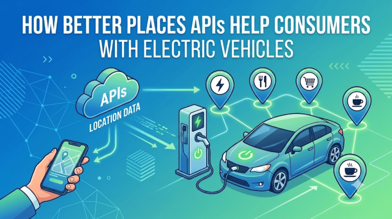
The bridge between the EV and the surrounding world of chargers, amenities, and routes is the Places API layer. Get that layer right and the entire EV experience becomes calm and predictable. Get it wrong and even the best car feels frustrating.
The single most common EV consumer question is some variant of “where is the nearest charger I can use right now”. Answering this question well requires more than a simple proximity query against a list of points on a map. The app needs to understand which chargers are compatible with the driver’s vehicle, which are operational, what charging speeds they support, and whether they are public, paid, or restricted to specific networks.
The Potters Maps Search API, drawing from the Potters Maps places database of over 70 million points of interest across multiple countries and territories, supports this kind of structured proximity search. Applications can query for charging stations within a defined radius of the vehicle’s current location, filter by relevant attributes, and surface the results in a ranked order that reflects what the driver actually needs. Because the underlying places database is continuously refreshed through AI-enhanced data processing, partner-sourced map data, and direct field collection via the Naksha data collection app, the records reflect the current state of the charging network rather than a stale snapshot. New chargers come online frequently and existing ones occasionally go out of service or change operating models, so this freshness directly determines the quality of the consumer experience.
EV apps are only as useful as the address data behind their charger records. When a driver taps a charging station in the app and asks for directions, the app routes them based on a coordinate associated with that record. If the underlying address data is inaccurate, incomplete, or pointing to the wrong entrance of a large parking facility, the driver may end up at the right building but the wrong location, wasting precious time and battery while searching.
The Potters Maps Address Validation API supports the upstream data quality of every charger record by parsing incoming addresses into structured components, validating them against authoritative reference data, and standardising the formatting. EV apps maintaining their own charger inventories, whether built from operator partnerships, public datasets, or community contributions, can run incoming records through this validation layer to ensure that every charger entering the consumer-facing database is reachable. The Potters Maps Autocomplete API supports the consumer side, allowing drivers searching for a destination or a planned charging stop to type partial inputs and receive validated suggestions, eliminating the time and frustration of free-form address entry on a touchscreen.
EV trip planning is fundamentally different from gasoline trip planning because the route has to accommodate charging stops along the way for any journey longer than a single battery range. Apps that help drivers plan these multi-leg journeys depend on precise coordinates for every potential charging stop. A coordinate placed even 100 metres away from the actual charger entrance can shift the calculated arrival time and add unnecessary battery consumption to reach the wrong spot.
The Potters Maps Forward Geocoding API converts charger addresses, customer destinations, and intermediate stops into coordinates that correspond to the actual physical access points rather than approximated street centroids. For an EV trip planner, this precision is what allows the calculated battery requirements at each leg to align with reality. A driver setting off on a 600 kilometre trip with planned charging stops at three locations along the route needs every one of those coordinates to be accurate, because the cumulative effect of small errors compounds into either inefficient charging stops or, worse, miscalculated remaining range.
The Forward Geocoding API also enriches each coordinate with attributes drawn from the underlying places database, allowing trip planning logic to factor in characteristics such as whether the charger is at a highway service area, a city centre lot, or a suburban shopping centre. These contextual signals help apps choose between candidate chargers based on more than just distance.
Once an EV driver is on the road, the experience depends heavily on real-time location awareness. The app needs to know where the driver currently is in order to suggest the next charger, calculate remaining range, and trigger alerts as the driver approaches a planned charging stop. All of this depends on a continuous stream of GPS coordinates being converted into meaningful addresses, neighbourhood names, and place identifiers.
The Potters Maps Reverse Geocoding API performs this conversion in real time, turning the raw coordinates the EV or smartphone reports into readable location descriptions the driver can act on. Notifications such as “your next charging stop is on the next exit” or “you are now passing a fast-charging station” rely on this conversion being accurate, fast, and consistent. The reverse geocoder also supports the post-trip analytics layer that many EV apps maintain, helping drivers understand their charging patterns and energy consumption across specific locations and routes over time.
Even when an EV driver has been routed to the precise coordinate of a charger, the final identification of which specific charging bay among many in a parking lot, or which entrance to a multi-level garage to use, can be challenging. Public charging infrastructure is often spread across malls, hotel parking lots, supermarket complexes, and office buildings, where the actual chargers may not be immediately visible from the road.
The Potters Maps Location Image API addresses this by providing imagery associated with specific points of interest, including charging stations. A driver pulling into an unfamiliar shopping centre to charge can compare the image in the app to what they see in front of them and identify the correct charger location in seconds rather than minutes of driving around the lot. The Potters Maps POI Extraction API, which uses OCR and language models to extract structured information from images, supports the ongoing maintenance of charger records by analysing storefront and signage photos captured in the field to detect changes in operator branding, charger types, or station status. Combined with the Naksha data collection app, which gives field teams a structured way to capture new images and submit them for processing, this creates a continuously refreshed visual layer that keeps pace with the rapid evolution of charging infrastructure.
A 20 to 45 minute charging stop is meaningfully different from a five minute petrol fill, and one of the secondary jobs of a great EV app is helping drivers turn each charging stop into a productive break. Coffee, food, restrooms, errands, or a quick shopping trip can transform what feels like wasted waiting into useful time. This kind of contextual recommendation requires the app to understand what is around each charger.
The Potters Maps Search API, querying the same 70 million point of interest database that powers the charger search, allows EV apps to surface relevant nearby amenities for any charging stop. Drivers can see at a glance whether the chosen charger is next to a cafe, near a supermarket, or close to a restroom, helping them choose between candidate stops based on what they will actually do during the charging session. For longer trips, this context helps drivers plan their breaks around amenities rather than just battery levels, turning charging stops from interruptions into deliberate parts of the journey.
The EV ecosystem is one of the most rapidly evolving categories in consumer infrastructure. New chargers are added every week. Operator networks change ownership. Charging speeds and connector standards continue to evolve. A Places API for EV use cases must therefore be continuously refreshed, not maintained as a periodic data drop. The combination of AI-enhanced data processing, partner-sourced map data, and direct field collection through the Naksha data collection app ensures that the Potters Maps places dataset reflects the current state of the charging network rather than the state of six months ago. For EV drivers, this freshness is the difference between an app they trust and one they routinely double-check against other sources.
The consumer EV experience is built on a foundation of location intelligence. Finding a compatible charger nearby, planning a multi-leg journey with confidence, navigating to the exact charger entrance, and turning a charging stop into a productive break are all questions that a Places API layer either answers well or struggles to answer at all. A unified location intelligence platform such as the Potters Maps Places API and Custom API suite, spanning Forward Geocoding, Reverse Geocoding, Autocomplete, Search, Address Validation, Location Image, and POI Extraction, provides exactly the foundation that modern EV applications need. As more drivers transition to electric, the apps that earn their loyalty will be the ones that make charging feel effortless. And the apps that make charging feel effortless will be the ones built on a Places API layer that is precise, current, visually rich, and globally consistent. Investing in that foundation is one of the most consequential infrastructure decisions any EV-focused product team can make.
Newsletter signup. Travel with confidence accurate road and traffic information.
© 2026 Potters Maps. All Rights Reserved.